Embedded telemetry + browser interface
GNSS and LoRa race tracking
Firmware and a browser interface for a radio-based race-tracking system. The work covers position and status packets, a LoRa-to-web gateway, map updates and GPX route logging.
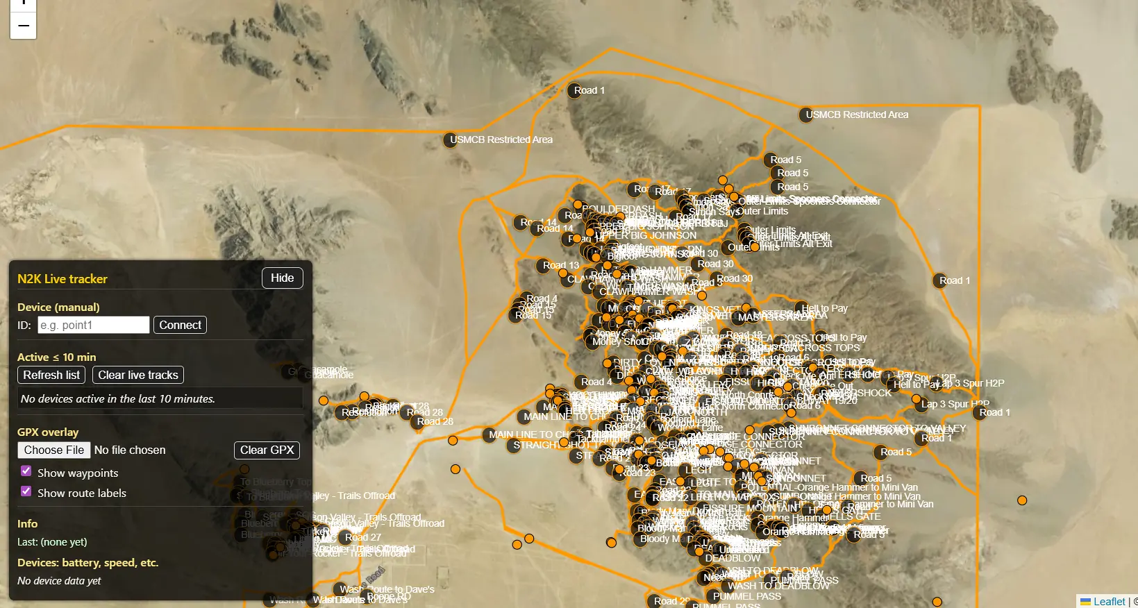
Engineering scope
- GNSS data handling and compact LoRa packets
- Gateway integration and WebSocket updates
- Browser map presentation and GPX route logging
Documented system flow
From position data to a route record
- Read GNSS measurementsCollect position and status values.
- Create a radio packetPackage telemetry for the LoRa link.
- Bridge to the webPass gateway updates to browser software.
- Show and record the routeUse the map interface and GPX logging.
Radio packets and gateway integration
Compact packets carry position and status over LoRa. The gateway converts the embedded data into WebSocket updates for the browser map, keeping radio transport and presentation separate.
Position validity handling
The sampling function checks location and satellite validity before copying coordinates. A fix flag distinguishes unavailable-position zero placeholders from valid coordinates. Auxiliary fields are checked independently and also default to zero when unavailable.
Validation scope
The source excerpt documents sampling logic; the project record covers the wider gateway, map and GPX logging. Radio range, positioning accuracy and completed field validation are not established by the available material.
Firmware flow
How the tracker prepares a GNSS sample
Complete GNSS sample-building routine.
Check that position and satellite data are valid with at least one satellite. Keep the coordinates when a fix is available; otherwise mark no fix and use zero placeholders. Add independently valid auxiliary readings, then update the latest fix, quality and satellite status.
The check is for reported field validity, not sample freshness or an accuracy threshold. Zero coordinates are placeholders when there is no fix. LoRa transmission, browser maps and GPX logging are outside this excerpt.
Read the implementation
buildGpsSample · selected source lines 1040–1053. Source inspection is not a hardware test.
void buildGpsSample(GpsSample &out) {
  out.fix         = gps.location.isValid() && gps.satellites.isValid() && gps.satellites.value() > 0;
  out.lat         = out.fix ? gps.location.lat()   : 0.0;
  out.lon         = out.fix ? gps.location.lng()   : 0.0;
  out.alt_m       = gps.altitude.isValid()   ? gps.altitude.meters() : 0.0;
  out.spd_mph     = gps.speed.isValid()      ? gps.speed.mph()       : 0.0;
  out.heading_deg = gps.course.isValid()     ? gps.course.deg()      : 0.0;
  out.hdop        = gps.hdop.isValid()       ? gps.hdop.hdop()       : 0.0;
  out.sats        = gps.satellites.isValid() ? gps.satellites.value(): 0;

  lastGpsFix = out.fix;
  lastHdop   = out.hdop;
  lastSats   = out.sats;
}Project enquiries
Discuss your project.
Tell us what you’re developing and where you need engineering support.